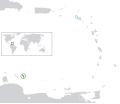
ဖုဲင်:BES islands location map.svg

Size of this PNG preview of this SVG file: ၆၉၈ × ၅၉၉ ပိစ်သယ်. ပွုံႏယောင်ꩻစဲင်းစဲ့ အလင်ဖုံႏ: ၂၈၀ × ၂၄၀ ပိစ်သယ် | ၅၅၉ × ၄၈၀ ပိစ်သယ် | ၈၉၄ × ၇၆၈ ပိစ်သယ် | ၁၁၉၂ × ၁၀၂၄ ပိစ်သယ် | ၂၃၈၅ × ၂၀၄၈ ပိစ်သယ် | ၁၃၄၆ × ၁၁၅၆ ပိစ်သယ်။
မူလဖုဲင် (SVG ဖုဲင်၊ ၁၃၄၆ × ၁၁၅၆ ပိစ်သယ်ဖေႏကျံႏညဏ်ႏဒျာႏ၊ ဖုဲင်ပေႏတန်: ၁၇၇ KB)
ဖုဲင်မုဲင်တန်ꩻ
ဖေႏကထီႏလꩻ ဖုဲင်နဝ်ꩻမွူးနီꩻအတွိုင်ꩻနဝ်ꩻ နျꩻသွော့ မွူးနီꩻ/အခိန်ႏ တဗာႏဗာႏလောင်း ကလိစ်သြ။
| မွူးနီꩻ/အခိန်ႏ | နမူႏနာႏပွုံႏစံႏပေႏ | ဒုဲင်မဲဉ်းသိဉ်းဖုံႏ | ကေားသုင်ꩻသား | တောင်ꩻသေꩻ | |
|---|---|---|---|---|---|
| ယိုခါကျာꩻ | ၂၂:၅၁၊ ၂၇ ဇွန် ၂၀၁၁ |  | ၁၃၄၆ × ၁၁၅၆ (၁၇၇ KB) | Thayts | Strokes tweak |
| ၀၂:၀၂၊ ၈ မတ် ၂၀၁၁ |  | ၁၃၄၆ × ၁၁၅၆ (၁၇၇ KB) | Thayts | Strokes tweak | |
| ၂၂:၂၈၊ ၆ မတ် ၂၀၁၁ |  | ၁၃၄၆ × ၁၁၅၆ (၁၇၇ KB) | Thayts | Strokes tweak | |
| ၂၂:၀၁၊ ၆ မတ် ၂၀၁၁ |  | ၁၃၄၆ × ၁၁၅၆ (၁၇၇ KB) | Thayts | Darker gray | |
| ၁၉:၂၄၊ ၆ မတ် ၂၀၁၁ |  | ၁၃၄၆ × ၁၁၅၆ (၁၇၇ KB) | Thayts | Minor changes | |
| ၀၃:၂၅၊ ၆ မတ် ၂၀၁၁ |  | ၁၃၄၆ × ၁၁၅၆ (၂၁၄ KB) | Thayts | Minor changes | |
| ၀၃:၁၀၊ ၆ မတ် ၂၀၁၁ |  | ၁၃၄၆ × ၁၁၅၆ (၂၁၅ KB) | Thayts | Made circles darker for better visibility | |
| ၀၃:၀၂၊ ၆ မတ် ၂၀၁၁ |  | ၁၃၄၆ × ၁၁၅၆ (၂၁၅ KB) | Thayts | {{Information |Description={{en|Location map of the BES islands in the Lesser Antilles}} Equirectangular projection, N/S stretching 103 %. Geographic limits of the map: * N: 19.2° N * S: 9.7° N * W: 70.5° W * |
သုင်ꩻဖုဲင်
လိတ်မဲ့ငါလ့နဝ်ꩻနဝ်ꩻ အဝ်ႏသွုံꩻခါꩻ ဖုဲင်ယိုသွူ:
ဂလိုဗယ် သုင်ꩻဖုဲင်
ဝီခီအလင်ဖုံႏကို အဝ်ႏသွုံꩻခါꩻ ဖုဲင်ယိုသွူ:
- သုင်ꩻအီ af.wikipedia.org ကို
- သုင်ꩻအီ ar.wikipedia.org ကို
- သုင်ꩻအီ arz.wikipedia.org ကို
- သုင်ꩻအီ awa.wikipedia.org ကို
- သုင်ꩻအီ azb.wikipedia.org ကို
- သုင်ꩻအီ az.wikipedia.org ကို
- သုင်ꩻအီ ban.wikipedia.org ကို
- သုင်ꩻအီ be.wikipedia.org ကို
- သုင်ꩻအီ bh.wikipedia.org ကို
- သုင်ꩻအီ bs.wikipedia.org ကို
- သုင်ꩻအီ ca.wikipedia.org ကို
- သုင်ꩻအီ ceb.wikipedia.org ကို
- သုင်ꩻအီ chy.wikipedia.org ကို
- သုင်ꩻအီ cs.wikipedia.org ကို
- သုင်ꩻအီ da.wikipedia.org ကို
- သုင်ꩻအီ de.wikipedia.org ကို
- သုင်ꩻအီ diq.wikipedia.org ကို
- သုင်ꩻအီ el.wikipedia.org ကို
- သုင်ꩻအီ en.wikipedia.org ကို
- သုင်ꩻအီ en.wiktionary.org ကို
- သုင်ꩻအီ eo.wikipedia.org ကို
- သုင်ꩻအီ es.wikipedia.org ကို
- သုင်ꩻအီ fa.wikipedia.org ကို
- သုင်ꩻအီ fi.wikipedia.org ကို
- သုင်ꩻအီ fr.wikipedia.org ကို
- သုင်ꩻအီ fy.wikipedia.org ကို
- သုင်ꩻအီ ga.wikipedia.org ကို
- သုင်ꩻအီ gd.wiktionary.org ကို
- သုင်ꩻအီ gl.wikipedia.org ကို
- သုင်ꩻအီ he.wikipedia.org ကို
- သုင်ꩻအီ hi.wikipedia.org ကို
- သုင်ꩻအီ hr.wikipedia.org ကို
- သုင်ꩻအီ hu.wikipedia.org ကို
- သုင်ꩻအီ hy.wikipedia.org ကို
- သုင်ꩻအီ ia.wikipedia.org ကို
- သုင်ꩻအီ id.wikipedia.org ကို
နွို့ထွား ကသုင်ꩻခါꩻအီဒါႏဖုဲင်ယို ခင်ႏလမ်းအလင်ဖုံႏကို။
