
ဖုဲင်:HohRiverTrail 7322.jpg
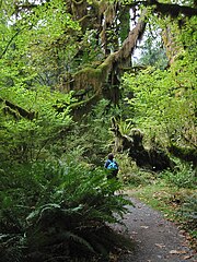
နမူႏနာႏယို ပေႏတန်: ၄၅၀ × ၆၀၀ ပိစ်သယ်။ ပွုံႏယောင်ꩻစဲင်းစဲ့ အလင်ဖုံႏ: ၁၈၀ × ၂၄၀ ပိစ်သယ် | ၃၆၀ × ၄၈၀ ပိစ်သယ် | ၅၇၆ × ၇၆၈ ပိစ်သယ် | ၁၂၀၀ × ၁၆၀၀ ပိစ်သယ်။
မူလဖုဲင် (၁၂၀၀ × ၁၆၀၀ pixels, ဖုဲင်ပေႏတန် - ၁.၁၇ MB, MIME အစွိုးအမျိုꩻ: image/jpeg)
| အွဉ်ႏနယ်ချက် |
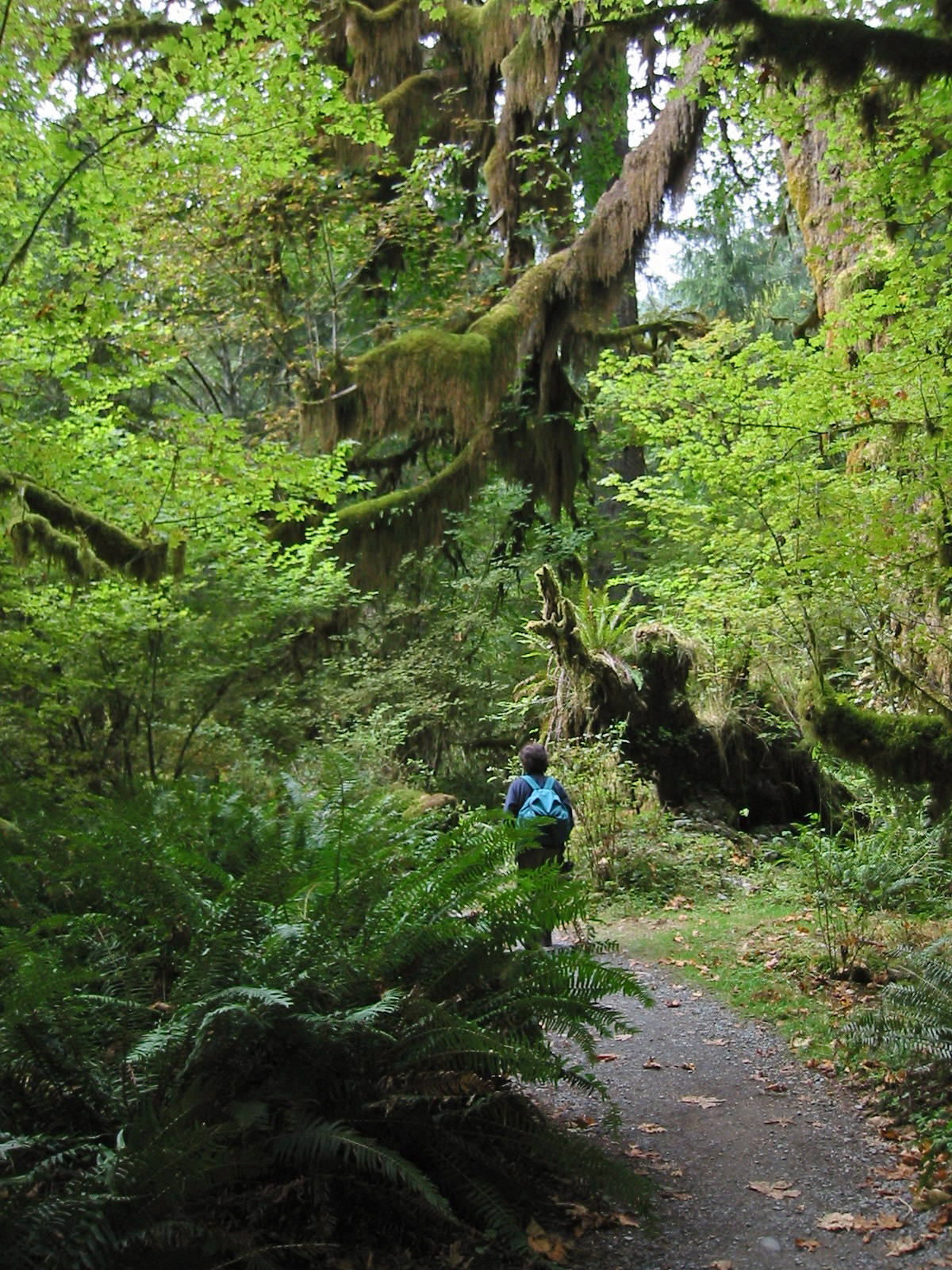
Spruce Nature Trail
|
| မွူးနီꩻ | ၁၇ သဲက်တဲဉ်ဗာ ၂၀၀၅, ၁၃:၅၃:၄၈ −၀၇:၀၀ |
| ရွီးခိုႏ | Self-published work by Wsiegmund |
| တဲမ်းလိတ်သား | Wsiegmund |
| Camera location | | View this and other nearby images on: OpenStreetMap |
|---|
(WGS84/NAD83)
ကျွန်ုပ်၊ ဤလုပ်ဆောင်ချက်၏ မူပိုင်ခွင့်ပိုင်ရှင်အနေဖြင့် ဤနေရာမှ အောက်ပါလိုင်စင်များအောက်တွင် ထုတ်လွှင့်ပါသည်:

|
လိတ်ယာႏယိုနဝ်ꩻ အဝ်ႏ GNU Free Documentation License, ဗားသိဉ်း ၁.၂ မွေးတဝ်းလဲ့ Free Software Foundation ကို ကဖြေ့ꩻလီခါꩻဒါႏ ဗားသိဉ်းကရီးခါဗာႏမုဲင်ꩻတယဝ်း ဗားသိဉ်းတဗာႏဗာႏဆꩻလ့နဝ်ꩻ Invariant Sections, Front-Cover Texts တောမ်ႏ Back-Cover Texts ဖုံႏ ပါတဝ်းလဲ့ ထူႏကူꩻဗိုန်၊ တိုတ်ꩻဖြေ့ꩻလီ တောမ်ႏ/မွေးတဝ်းလဲ့ ဖျက်ပြောင်ꩻလုဲင်ꩻနွောင်ꩻတာႏ ဖေႏခါꩻဒျာႏအခွင်ꩻသွူ။ လုဲင်သိဉ်မူပွာꩻယို သော့ꩻခါꩻဒျာႏ GNU Free Documentation License ကတူႏစဲဉ်ႏကိုသွူ။ |
ဖုဲင်ယိုနဝ်ꩻ အွောန်ႏထွော့ခါꩻဒျာႏ တောမ်ႏ Creative Commons [[creativecommons
|
||
| ||
| This licensing tag was added to this file as part of the GFDL licensing update. |
ဤဖိုင်သည် Creative Commons Attribution 2.5 Generic လိုင်စင်အောက်တွင် လိုင်စင်သတ်မှတ်ထားပါသည်။
- နာꩻနဝ်ꩻ လွစ်လွစ်တခြင်:
- ဖန်းဖြယ် – ထူႏကူꩻဗွိုန်၊ ဖန်းဖြယ်လီ တောမ်ႏ ထေဒင်ႏ ဖန်ဆင်ꩻမုꩻ
- အွောန်ႏရော်ꩻချာယင်း – ဖျင်ဆင်ခြပ်ချော်ꩻ ဖန်ဆင်ꩻမုꩻ
- အခေႏနေႏနုဲင်းလ့နဝ်ꩻဖုံႏကိုနဝ်ꩻ:
- ထူႏမတ်နွောင်ꩻဒျာႏ – နာꩻမိဉ်ႏမာꩻထိုꩻ ပြောင်ꩻလုဲင်ႏမုꩻဖုံႏနဝ်ꩻ ဖန်ဆင်ꩻသား မွေးတဝ်းလဲ့ လုဲင်သိဉ်အဝ်ႏသား ကအွောန်ႏထွော့ခါꩻဒါႏ စီꩻကန်ꩻအစွိုးအမျိုꩻနဝ်ꩻ လွောက်ꩻနာႏဗာႏနဝ်ꩻသွူ (ကမဲဉ်ရိုꩻနဝ်ꩻ နာꩻ မွေးတဝ်းလဲ့ နာꩻဖန်ဆင်ꩻမုꩻကို ကသွုံꩻအီတာႏနဝ်ꩻ ထောက်ခံႏခါꩻဖေႏနုဲင်းနဝ်ꩻ မွေးတဝ်းသွူ)။
နာꩻကလိုႏဒါႏ လုဲင်သိဉ်ယို လွိုက်နွောင်ꩻဒျာႏသွူ။
ဖုဲင်မုဲင်တန်ꩻ
ဖေႏကထီႏလꩻ ဖုဲင်နဝ်ꩻမွူးနီꩻအတွိုင်ꩻနဝ်ꩻ နျꩻသွော့ မွူးနီꩻ/အခိန်ႏ တဗာႏဗာႏလောင်း ကလိစ်သြ။
| မွူးနီꩻ/အခိန်ႏ | နမူႏနာႏပွုံႏစံႏပေႏ | ဒုဲင်မဲဉ်းသိဉ်းဖုံႏ | ကေားသုင်ꩻသား | တောင်ꩻသေꩻ | |
|---|---|---|---|---|---|
| ယိုခါကျာꩻ | ၀၉:၁၅၊ ၅ နိုဝဲင်ဗာ ၂၀၁၁ | | ၁၂၀၀ × ၁၆၀၀ (၁.၁၇ MB) | Wsiegmund | Photoshop Elements 4.0; 30% Auto Smart Fix, Adjust Lighting/Shadows/Highlights, Levels tools |
| ၀၉:၀၃၊ ၅ နိုဝဲင်ဗာ ၂၀၁၁ |  | ၁၂၀၀ × ၁၆၀၀ (၈၇၀ KB) | Wsiegmund | Uploaded original version | |
| ၁၂:၁၆၊ ၂၃ သဲက်တဲဉ်ဗာ ၂၀၀၅ |  | ၆၀၀ × ၈၀၀ (၂၉၂ KB) | Wsiegmund | '''Hoh River Trail''' * Features: Vine Maple (light green leaves), Sword Fern (on both sides of trail), moss covered maple limbs and roots, and hiker. * Location: Hoh River Trail about 1 km from the Hoh Rain Forest Visitor Center. The Hoh River Valley is |
သုင်ꩻဖုဲင်
လိတ်မဲ့ငါလ့နဝ်ꩻနဝ်ꩻ အဝ်ႏသွုံꩻခါꩻ ဖုဲင်ယိုသွူ:
ဂလိုဗယ် သုင်ꩻဖုဲင်
ဝီခီအလင်ဖုံႏကို အဝ်ႏသွုံꩻခါꩻ ဖုဲင်ယိုသွူ:
- သုင်ꩻအီ bn.wikipedia.org ကို
- သုင်ꩻအီ ca.wikipedia.org ကို
- သုင်ꩻအီ cs.wikipedia.org ကို
- သုင်ꩻအီ de.wikipedia.org ကို
- သုင်ꩻအီ en.wikipedia.org ကို
- သုင်ꩻအီ eu.wikipedia.org ကို
- သုင်ꩻအီ fa.wikipedia.org ကို
- သုင်ꩻအီ hi.wikipedia.org ကို
- သုင်ꩻအီ hy.wikipedia.org ကို
- သုင်ꩻအီ ja.wikipedia.org ကို
- သုင်ꩻအီ la.wikipedia.org ကို
- သုင်ꩻအီ nl.wikipedia.org ကို
- သုင်ꩻအီ pl.wikibooks.org ကို
- သုင်ꩻအီ pt.wikipedia.org ကို
- သုင်ꩻအီ ro.wikipedia.org ကို
- သုင်ꩻအီ si.wikipedia.org ကို
- သုင်ꩻအီ sq.wikipedia.org ကို
- သုင်ꩻအီ sr.wikipedia.org ကို
- သုင်ꩻအီ vi.wikipedia.org ကို